


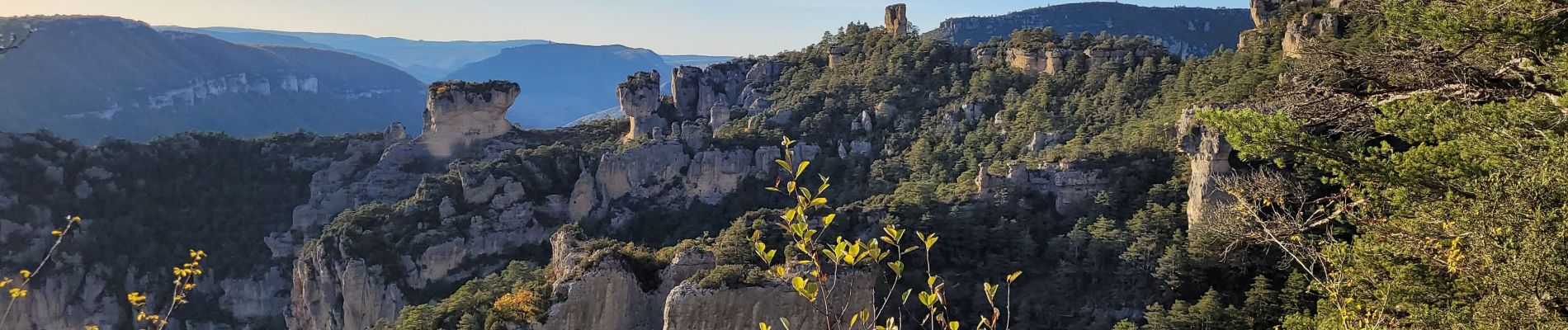
les corniches du Méjean (la Jonte)

amiral13
User GUIDE
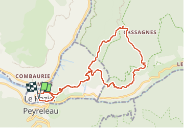

Length
12.5 km

Max alt
871 m

Uphill gradient
767 m
Km-Effort
23 km

Min alt
398 m

Downhill gradient
762 m
Boucle
Yes
Creation date :
2022-11-12 09:20:57.444
Updated on :
2022-11-12 16:37:15.091
7h15
Difficulty : Medium

FREE GPS app for hiking
 SityTrail
IGN / Geographical institutes
SityTrail Plus
The world is yours!
About
Trail Walking of 12.5 km to be discovered at Occitania, Lozère, Le Rozier. This trail is proposed by amiral13.
Photos
 - Photo 1")
 - Photo 2")
 - Photo 3")
 - Photo 4")
 - Photo 5")
 - Photo 6")
 - Photo 7")
 - Photo 8")
 - Photo 9")
 - Photo 10")
 - Photo 11")
 - Photo 12")
 - Photo 13")
 - Photo 14")
 - Photo 15")
 - Photo 16")
 - Photo 17")
 - Photo 18")
 - Photo 19")
 - Photo 20")
 - Photo 21")
 - Photo 22")
 - Photo 23")
 - Photo 24")
24 photos in total. Please click on a photo to see them all in the gallery.
Positioning
Country:
France
Region :
Occitania
Department/Province :
Lozère
Municipality :
Le Rozier
Location:
Unknown
Start:(Dec)
Start:(UTM)
516577 ; 4893116 (31T) N.
Comments